

JK Antennas has an online tool to plot elevation patterns and gain compared to flat ground at your location using USGS terrain data.
https://jkantennas.com/tools.html
Of course the antenna selections available are the antennas they sell. There will not be much difference between their antennas than anyone else's for the same number of elements, and same boom length.
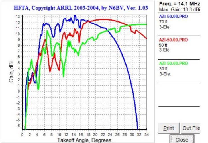
I have the JK 2040 Osprey. Four elements on 20 meters, and three elements on 40 meters, on a 30ft boom. In 2018 I ran my own calculations using the HFTA software that came with the ARRL Antenna book and the US Geological Service (aka USGS) terrain data from N6BV. Here was my plot on 20m pointed 50 degrees. The plot shows three heights. The antennas was installed at 70ft.
Here are the plots from the JK calculator.
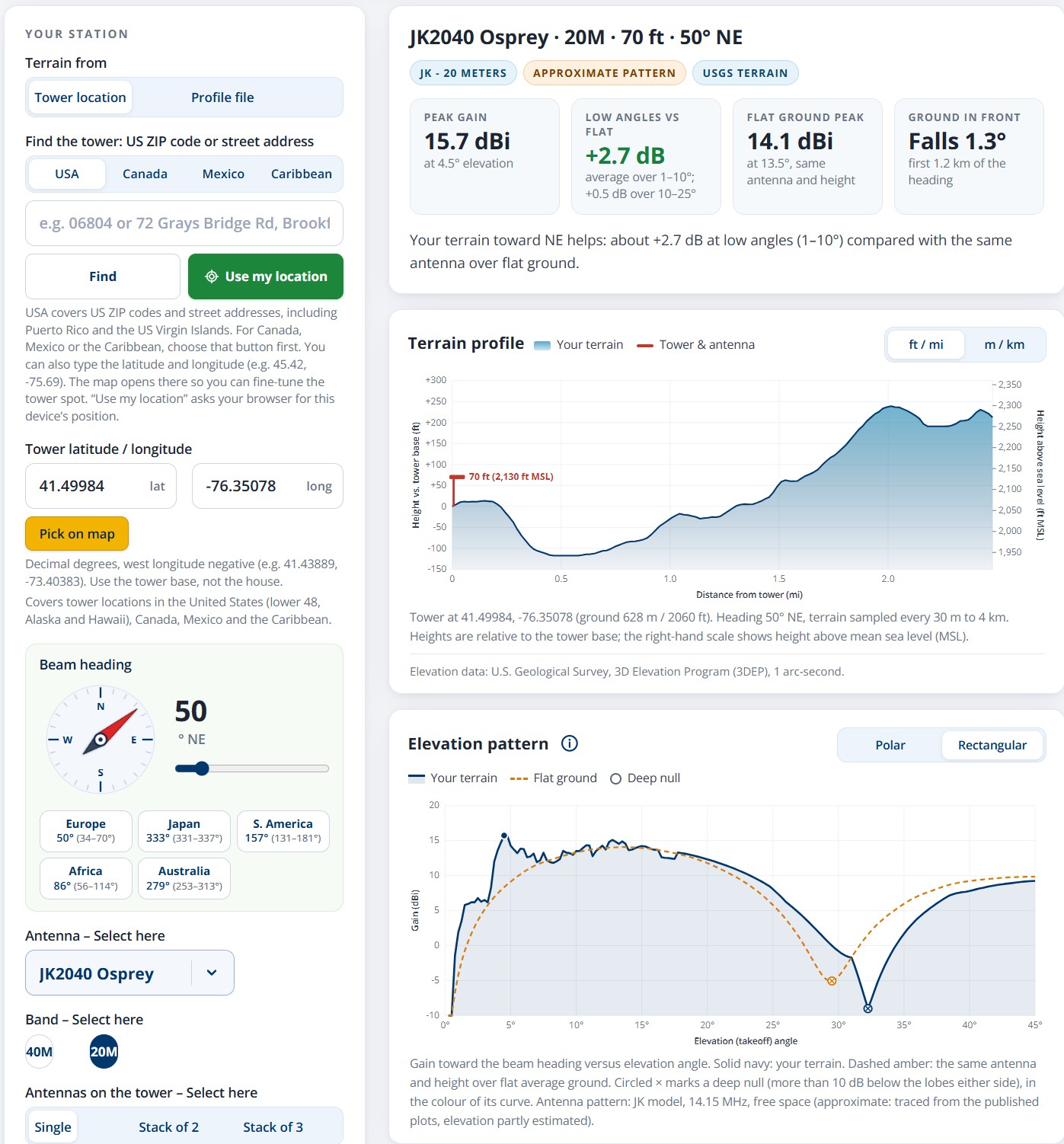
As you can see the plots are very close. The JK calculator is so much easier to use. Getting the USGS terrain data for use in the ARRL HFTA program is a PIA.
The JK calculator also plots the Polar Pattern at the same time. Here is the polar plot. Can't find my HFTA polar plot
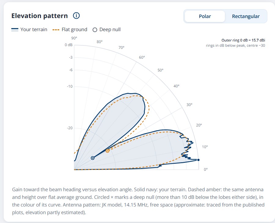
This a great tool to help you understand your antenna site. Sometimes that extra tower height, or extra elements on the boom won't make a big enough difference to spend the extra money. A dB or two won't be noticed by the guy at the other end of the QSO.
The JK calculator also estimates arrive angles based on the HFTA data. Take that with a grain of salt. Too many variables to accurately predict.
JK also has an online Mast calculator and a Guy clearance calculator.
Anyway....just thought I would pass this on. I know this will be minutia for most people.
https://jkantennas.com/tools.html
Of course the antenna selections available are the antennas they sell. There will not be much difference between their antennas than anyone else's for the same number of elements, and same boom length.
I have the JK 2040 Osprey. Four elements on 20 meters, and three elements on 40 meters, on a 30ft boom. In 2018 I ran my own calculations using the HFTA software that came with the ARRL Antenna book and the US Geological Service (aka USGS) terrain data from N6BV. Here was my plot on 20m pointed 50 degrees. The plot shows three heights. The antennas was installed at 70ft.
Here are the plots from the JK calculator.
As you can see the plots are very close. The JK calculator is so much easier to use. Getting the USGS terrain data for use in the ARRL HFTA program is a PIA.
The JK calculator also plots the Polar Pattern at the same time. Here is the polar plot. Can't find my HFTA polar plot
This a great tool to help you understand your antenna site. Sometimes that extra tower height, or extra elements on the boom won't make a big enough difference to spend the extra money. A dB or two won't be noticed by the guy at the other end of the QSO.
The JK calculator also estimates arrive angles based on the HFTA data. Take that with a grain of salt. Too many variables to accurately predict.
JK also has an online Mast calculator and a Guy clearance calculator.
Anyway....just thought I would pass this on. I know this will be minutia for most people.
Last edited:
