• You can now help support WorldwideDX when you shop on Amazon at no additional cost to you! Simply follow this Shop on Amazon link first and a portion of any purchase is sent to WorldwideDX to help with site costs.

beam direction

klloyd

KN4OIN
May 15, 2012
14
0
11
I'm hearing a lot of Asia and Russian skip on 27.555, well I hear others talking to them. I did actually hear japan from the mobile the other day... but I was unable to return the dx call. To many jumped him...
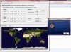
My question is, which way do I need to point the beam, north over the poles, or east? I've hit England often from South Carolina pointing east. Never heard Russia or any asian country... Less Japan. I think they are pointing north, but I'm not sure. So I wanted to see what you guys think.

KL
 

would pointing the beam in the best direction for RX also give the best chance of TXing since they are supposed to be reciprocal ?
why not try each direction and see what works better ?
 
  • Like
Reactions: 1 person
I use the Google Earth download. Use the ruler function and draw a point from your station to the station area you are targeting and set the end point. It will automatically calculate the shortest distance in azimuth direction/degrees. Shows the distance as well.
Point and shoot . . .
 

Attachments

  • CA to Spain.jpg
    CA to Spain.jpg
    271.6 KB · Views: 5
Last edited:
This forum taught me that at HF frequencies, the precise direction to point a beam is not so critical because the beamwidths tend to be wide 60° to 85° depending on boom lenght and number of elements. I found this tool to eliminate guesswork. Given the latitude, longitude and elevation of two points on the Earth (use Google Earth), this calculator determines the azimuth (compass direction) and distance of the second point (B) as seen from the first point (A). Credit goes to Don Cross.

Azimuth/Distance calculator by Don Cross
 
  • Like
Reactions: 928bolo
This forum taught me that at HF frequencies, the precise direction to point a beam is not so critical because the beamwidths tend to be wide 60° to 85° depending on boom lenght and number of elements. I found this tool to eliminate guesswork. Given the latitude, longitude and elevation of two points on the Earth (use Google Earth), this calculator determines the azimuth (compass direction) and distance of the second point (B) as seen from the first point (A). Credit goes to Don Cross.

Azimuth/Distance calculator by Don Cross

This azimuthal map is centered on Columbia SC, should be close enough for you.
 

Attachments

  • Wire Dawg.gif
    Wire Dawg.gif
    29.7 KB · Views: 17
Thanks IMD262 for the map. I found the azimuth calculator more practical because I can apply the results directly with a magnetic compass. Most azimuthal maps will use true north as a reference, which does not always coincide with the magnetic north shown on a compass (the deviation depends on your location). If one opts for the maps, I'd suggest to use a calculator such as the one posted by W5LZ, as it will most likely provide an up to date version.
 
Thanks IMD262 for the map. I found the azimuth calculator more practical because I can apply the results directly with a magnetic compass. Most azimuthal maps will use true north as a reference, which does not always coincide with the magnetic north shown on a compass (the deviation depends on your location). If one opts for the maps, I'd suggest to use a calculator such as the one posted by W5LZ, as it will most likely provide an up to date version.

My bad... that should have been for klloyd.
 
Thanks IMD262 for the map. I found the azimuth calculator more practical because I can apply the results directly with a magnetic compass. Most azimuthal maps will use true north as a reference, which does not always coincide with the magnetic north shown on a compass (the deviation depends on your location). If one opts for the maps, I'd suggest to use a calculator such as the one posted by W5LZ, as it will most likely provide an up to date version.


On an azimuthal equidistant map aka Great Circle map north is north. There is no magnetic declination on such maps. Everything is referenced to the center of the map and each map is drawn for a specific location. Directional antennas should always be set up with TRUE north as a reference. That way you make the offset once when setting things up instead of every time you want to point somewhere.
 
I wholeheartedly agree that the rotor, control box & antenna must be set by true north from the get-go. At first, I was unable to determine how to physically point the antenna by referencing only the azimuthal map, without the use of a magnetic compass. Since there is a difference between the map’s true north and the compass’s magnetic north, I sensed that pointing the antenna by the compass reading, while trying to reach a specific coordinate on the map, would not yield the best results. One of my earlier questions in this forum was in regards to how to calculate the difference between magnetic vs true north in order to point the beams correctly. As in this thread initiated by klloyd, CK and many others were extremely helpful. Thanks.
 

dxChat
Help Users
  • No one is chatting at the moment.
  • @ Wildcat27:
    Hello I have a old school 2950 receives great on all modes and transmits great on AM but no transmit on SSB. Does anyone have any idea?
  • @ ButtFuzz:
    Good evening from Sunny Salem! What’s shaking?
  • dxBot:
    63Sprint has left the room.