APRS & GPS Continued
I've spent the better part of my "radio time" over the last few days attempting to get the TH-D72's APRS and GPS functions to communicate with my PC to do more advanced tasks than just programming the radio. It hasn't been as simple as I had hoped, but I have been successful.
The first problem that I had was trying to install the USB drivers from Silicon Labs on my Windows Vista PC. The install was unsuccessful several times and I still haven't accomplished that task. I'm sure I can resolve the problem, but I decided to go back to the Windows 7 PC where I had already successfully worked with the driver and radio. I own a current copy of Microsoft MapPoint and wanted to see if the TH-D72's GPS could send its info to the software to display my current location. I enabled the PC Output option under GPS settings and then configured MapPoint to receive GPS updates from the specified port. Despite every possible USB COM port configuration, MapPoint only reported that it could see that the, "...GPS is sending data, but it is not in the required NMEA 2.0 format". I decided to try Google Earth to accomplish the same thing and it also could not interpret the info sent from the TH-D72.
I wanted to see for myself what was being sent from the radio, so next I installed a COM port logger to capture the packets sent to the PC. I was shocked when I captured this:
$
†„„ä„ąć¤ÄÄ…椅&††Ä„dž¤¤§FƤåÄÂâ€\
žÃ¤Ã„„„‡DÆ’!ÀÀÅ¥¦Ä…¦Ä…¦Å„¦Å„†ÅÆ„§†äÆ„‡\
‡AÆ’!ÃÅÄ„¦ÅŦ„¦Æ…¦Ä„ÅŦĄ¦Å¦Ä…†Å…Ä¥§@Æ\
’!ÃÅÅ„†Ä
After poking around in the Windows Device Manager, I noticed that Windows had not only detected the USB serial port, but also had added a failed installation of a new Microsoft trackball mouse that I don't have. Plugging and unplugging the radio verified that this "mouse" was indeed related to the radio. For whatever reason, the driver had not installed properly on my Windows 7 PC, either. I completely uninstalled the driver, reinstalled and initiated a new COM port log. Now I got this:
$GPGGA,063045.000,3409.5571,N,11759.5660,W,1,04,03.0,00242.1,M,-033.0,M,000.0,0000*4D
$GPGSA,A,3,30,16,23,31,,,,,,,,,04.3,03.0,03.1*03
$GPGSV,3,1,12,20,74,212,,23,55,329,21,32,54,152,18,16,50,097,21*72
$GPGSV,3,2,12,13,29,301,,30,23,048,24,31,18,047,22,07,14,239,*7A
$GPGSV,3,3,12,24,09,196,,04,07,310,,11,05,208,,03,01,140,*72
$GPRMC,063045.000,A,3409.5571,N,11759.5660,W,0001.69,305.81,141210,,*25
This looks much better! I tried it again with Microsoft MapPoint and also Google Earth, but neither still likes the message format. I'm not up to speed on the NMEA 2.0 message format, but apparently what the TH-D72 sends isn't it.
Before going any further with the USB interface, I turned off the GPS output and turned on the APRS PC output. Here is a sample of what I captured:
cmd:W6COH-10>APX194,KF6ILA-10,N6EX-1*:=3344.75N111658.13W#PHG7190XASTIR-Linux iGate Hemet,CA
N6QZV-2>SSTRSX,N6EX-1*,WIDE2-1:`-Vfl!n-/]"3v}
N6EX-1>APNU19-3:!3411.21N111802.13W#PHG5664/LA Area W1/A=003000/sceara@ham-radio.com
N6EX-1>APNU19-2,N6EX-5*:!3411.21N111802.13W#PHG5664/LA Area W1/A=003000/sceara@ham-radio.com
K6PYT-1>APT311,N6EX-1*,WIDE2-1:/140640z3403.38N/11756.32Wk205/000/A=000357
These APRS messages looked promising so I decided to give it a try with APRSPoint. Unfortunately, APRSPoint was never able to open the the TH-D72's TNC. I decided to give APRSIS32 a try after seeing G4ILO's report that he was able to work the HT with it. I had to figure out the correct combination of settings, but it worked! One tip: you can't turn on both the GPS output and APRS output on the HT at the same time; APRSIS32 can't address both functions on the same COM port. Here is a sample screen after letting the application receive some APRS info for a few minutes, monitoring only the RF port:

I was also able to set APRSIS32 to control the TNC and send a message over the air using my PC and TH-D72 to my other APRS radios. I turned off the TNC connection and enabled the GPS connection, and found that it works with APRSIS32 also. So, despite a rocky start, I've found that the TH-D72 is indeed capable of working with software applications to do APRS and GPS tracking.
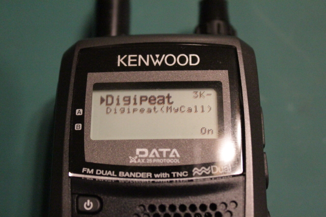
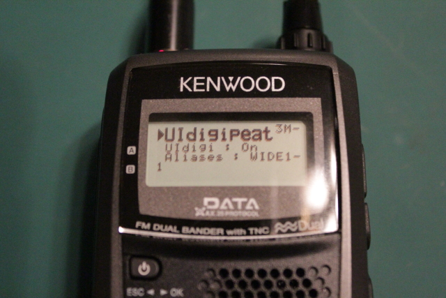
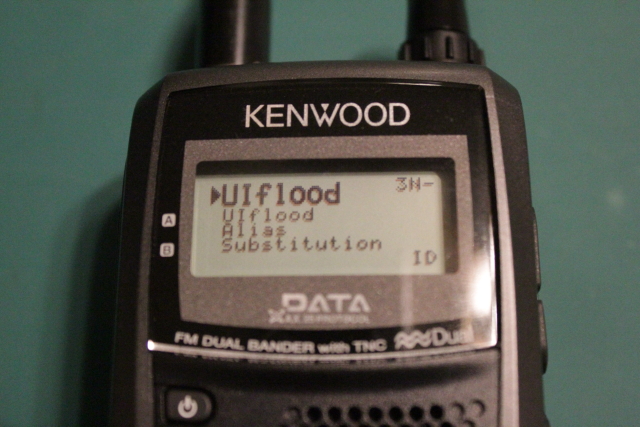
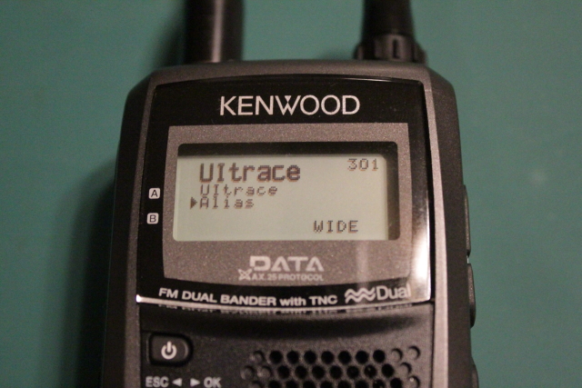
Next, I'll discuss the digipeating capabilities in the HT
I've spent the better part of my "radio time" over the last few days attempting to get the TH-D72's APRS and GPS functions to communicate with my PC to do more advanced tasks than just programming the radio. It hasn't been as simple as I had hoped, but I have been successful.
The first problem that I had was trying to install the USB drivers from Silicon Labs on my Windows Vista PC. The install was unsuccessful several times and I still haven't accomplished that task. I'm sure I can resolve the problem, but I decided to go back to the Windows 7 PC where I had already successfully worked with the driver and radio. I own a current copy of Microsoft MapPoint and wanted to see if the TH-D72's GPS could send its info to the software to display my current location. I enabled the PC Output option under GPS settings and then configured MapPoint to receive GPS updates from the specified port. Despite every possible USB COM port configuration, MapPoint only reported that it could see that the, "...GPS is sending data, but it is not in the required NMEA 2.0 format". I decided to try Google Earth to accomplish the same thing and it also could not interpret the info sent from the TH-D72.
I wanted to see for myself what was being sent from the radio, so next I installed a COM port logger to capture the packets sent to the PC. I was shocked when I captured this:
$
†„„ä„ąć¤ÄÄ…椅&††Ä„dž¤¤§FƤåÄÂâ€\
žÃ¤Ã„„„‡DÆ’!ÀÀÅ¥¦Ä…¦Ä…¦Å„¦Å„†ÅÆ„§†äÆ„‡\
‡AÆ’!ÃÅÄ„¦ÅŦ„¦Æ…¦Ä„ÅŦĄ¦Å¦Ä…†Å…Ä¥§@Æ\
’!ÃÅÅ„†Ä
After poking around in the Windows Device Manager, I noticed that Windows had not only detected the USB serial port, but also had added a failed installation of a new Microsoft trackball mouse that I don't have. Plugging and unplugging the radio verified that this "mouse" was indeed related to the radio. For whatever reason, the driver had not installed properly on my Windows 7 PC, either. I completely uninstalled the driver, reinstalled and initiated a new COM port log. Now I got this:
$GPGGA,063045.000,3409.5571,N,11759.5660,W,1,04,03.0,00242.1,M,-033.0,M,000.0,0000*4D
$GPGSA,A,3,30,16,23,31,,,,,,,,,04.3,03.0,03.1*03
$GPGSV,3,1,12,20,74,212,,23,55,329,21,32,54,152,18,16,50,097,21*72
$GPGSV,3,2,12,13,29,301,,30,23,048,24,31,18,047,22,07,14,239,*7A
$GPGSV,3,3,12,24,09,196,,04,07,310,,11,05,208,,03,01,140,*72
$GPRMC,063045.000,A,3409.5571,N,11759.5660,W,0001.69,305.81,141210,,*25
This looks much better! I tried it again with Microsoft MapPoint and also Google Earth, but neither still likes the message format. I'm not up to speed on the NMEA 2.0 message format, but apparently what the TH-D72 sends isn't it.
Before going any further with the USB interface, I turned off the GPS output and turned on the APRS PC output. Here is a sample of what I captured:
cmd:W6COH-10>APX194,KF6ILA-10,N6EX-1*:=3344.75N111658.13W#PHG7190XASTIR-Linux iGate Hemet,CA
N6QZV-2>SSTRSX,N6EX-1*,WIDE2-1:`-Vfl!n-/]"3v}
N6EX-1>APNU19-3:!3411.21N111802.13W#PHG5664/LA Area W1/A=003000/sceara@ham-radio.com
N6EX-1>APNU19-2,N6EX-5*:!3411.21N111802.13W#PHG5664/LA Area W1/A=003000/sceara@ham-radio.com
K6PYT-1>APT311,N6EX-1*,WIDE2-1:/140640z3403.38N/11756.32Wk205/000/A=000357
These APRS messages looked promising so I decided to give it a try with APRSPoint. Unfortunately, APRSPoint was never able to open the the TH-D72's TNC. I decided to give APRSIS32 a try after seeing G4ILO's report that he was able to work the HT with it. I had to figure out the correct combination of settings, but it worked! One tip: you can't turn on both the GPS output and APRS output on the HT at the same time; APRSIS32 can't address both functions on the same COM port. Here is a sample screen after letting the application receive some APRS info for a few minutes, monitoring only the RF port:

I was also able to set APRSIS32 to control the TNC and send a message over the air using my PC and TH-D72 to my other APRS radios. I turned off the TNC connection and enabled the GPS connection, and found that it works with APRSIS32 also. So, despite a rocky start, I've found that the TH-D72 is indeed capable of working with software applications to do APRS and GPS tracking.
Next, I'll discuss the digipeating capabilities in the HT


